Fall in Boise is incredible and it’s the ideal time of year for this destination to show off its natural beauty. There are so many ways to view the changing foliage and enjoy the cooler temperatures, but what better way than getting out on the trail with your family? Whether you have toddlers or teens, here are five of the best local, kid-friendly hikes to get everyone outdoors and enjoying crisp, Idaho air together.
Mores Mountain Interpretive Trail

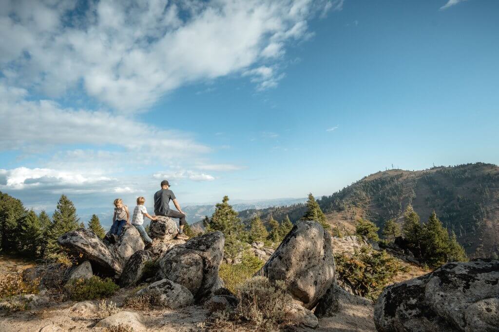
This hike is hands-down a top pick for mountain range views and classic orange and yellow foliage in the Boise foothills. The trail offers views looking up to Bogus Basin, down toward the Treasure Valley and over to the Sawtooth Mountain Range. The ease of the hike and panoramic vistas are what land this Boise foothills trail as an autumn staple for my family! The route is well-maintained and takes you through thick groves of trees that provide plenty of shade. The upper portion of the trail hosts giant boulders for kids to climb across, or sit and eat their snacks. Truly one of Boise’s most beautiful family-friendly hikes, Mores Mountain is a marvelous trail for hikers of all ages and skill levels and a must-see in the autumn months!
Directions
From Boise, travel along Bogus Basin Road for approximately 20 miles. Continue past the Bogus Basin ski area and Nordic ski center. Drive three miles on a gravel road until you reach the junction in the road. Turn east at the junction and travel slightly more than one mile to the Shafer Butte Campground and Picnic Area. The Mores Mountain Interpretive Trailhead can be accessed near the entrance to the campground.
Details
- 2.2-mile loop
- 551-foot elevation gain
- Dog-friendly
- Restrooms available at the campground during summer months
Freddy’s Stack Rock Trail

Freddy’s Stack Rock, more popularly called “Stack Rock,” is a frequented 11.7-mile out-and-back path in the Boise foothills trail system. Some would argue it isn’t considered a kid-friendly hike, but the majority of the lower portion of the route is flat. When we take our kids, they hike as far as they want before we turn around and go back. We have not made it all the way through the trail to Stack Rock yet, but we’re working up to it! The trail winds through corridors of ponderosa pines and bright yellow blooms of sagebrush and provides stunning views of the Treasure Valley. Whether you go part of the way or tackle it all, you just have to go! (Tip: Be mindful of mountain bikers, as this is a popular trail for them.)
Directions
From Boise, travel along Bogus Basin Road for about 13 miles. There are currently two parking areas for Stack Rock. The upper parking lot is well-marked, significantly larger and has bathrooms.
Kid-friendly hike tip: If you park at the lower lot (which is a small gravel pull-off on the right of the road), you can cut out exactly one mile and the majority of elevation gain on the path. Cross Bogus Basin Road from where you park, and the trail starts out with a quarter-mile of sagebrush terrain before it winds back into the trees. With three small kids in tow, this is the route we tend to prefer.
Details
- 11.7 miles out-and-back
- 1,352-foot elevation gain
- Dog-friendly
- Restrooms available at the upper parking lot
Jump Creek Falls Trailhead

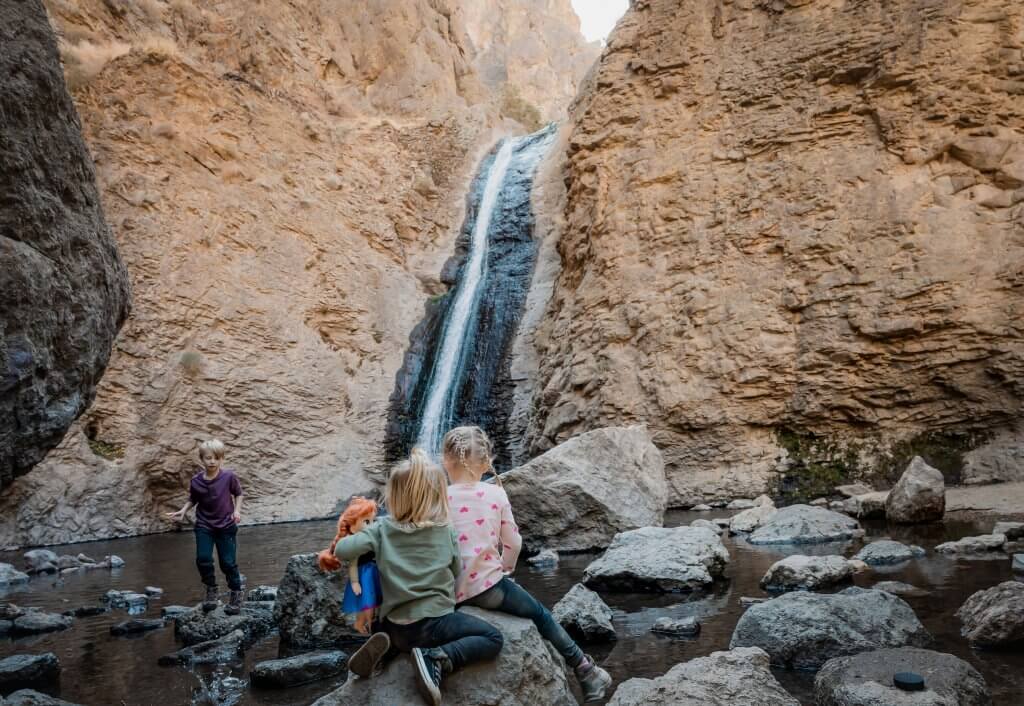
This light, .6-mile out-and-back hike is a kid’s dream. The journey to Jump Creek Falls is one you’ll find your family returning to over and over again. The trail is rocky but well-maintained, taking you through a canyon, crossing a creek and ending at the base of a sensational 60-foot waterfall. Our kids love to explore small caves along the trail and take their time playing in the creek before reaching the end. It’s a very popular spot in the summer months but does slow down substantially when the time arrives for fall hikes near Boise. The first portion of the trail is well-shaded with red osier dogwood and yellow birch that should be in full color by late October. This simple hike is splendid for those with little kids and those who want to immerse themselves in nature without going too far into the Idaho wilderness. Be aware: Poison ivy grows here on certain spots of the trail. Make sure to educate your children on what to look for and be mindful of the vegetation.
Directions
From Boise, take Interstate 84 west to the Nampa exit for Idaho State Highway 55 (Exit 33A). Follow Idaho State Highway 55 through Marsing to the junction with U.S. Route 95. Continue one mile past the junction and turn left onto Cemetery Road. When Cemetery Road dead-ends at the T-intersection, turn left at the onto Jump Creek Road. Follow Jump Creek Road through the Poison Creek intersection for roughly half a mile. When the road turns to gravel, take a right and cross the cattle guard. The section following is a public route through private property, so follow signage and stay on the main road to the recreation area. Please respect private property throughout the drive.
Details
- 0.6 miles out-and-back
- 98-foot elevation gain
- Dog-friendly
- Restrooms available
Sweet Connie’s Trailhead

This close-to-home, totally beautiful trail is roughly 12 miles out-and-back. However, it’s another of the Boise foothills’ family-friendly hikes that we take little by little with our littles! We enjoy the rolling hills, towering boulders and unique landscape. The trail is narrow yet well-maintained and a bit exposed. This hike near Boise is a wonderful route to check out once the weather cools off. If you follow the trail for .07 miles you’ll come to an excellent collection of boulders. This area is a rock-climbing kiddo’s dream come true and a great place to break for lunch. We usually hike a total of 1.5 miles down to the South Fork Daniels Creek to the crossing of Peggy’s Trail, and then hike back. This is a fairly popular mountain bike trail, so be mindful of your children and passing bikers.
Directions
From Boise, travel along Bogus Basin Road for 5.7 miles. You will see a long corridor of perpendicular parking spots on the right side of the road. Cross Bogus Basin Road and look for the trail sign. There is a fence to keep ATVs out, so be sure to close the fence behind you.
Details
- 12 miles out-and-back
- 2,020-foot elevation gain
- Dog-friendly
- No restrooms available
Elephant Rock Loop Trail

Elephant Rock is an easy .9-mile “lollipop loop” Boise foothills trail, which is a great fit for beginner hikers and tots just starting to meander on their own. The trail is sandy but well-maintained and has a slight incline that can get your heart pumping. If you hike straight up from the road, it will take you to the enormous “Elephant Rock” that resembles an elephant. It’s a fantastic spot for kiddos to slide, climb and adventure their hearts out. We typically hike up to the rock to climb and snack before making our way up and around the loop. At the top of this kid-friendly hike, you’ll find sweeping views of Boise and beyond, which makes it an awesome choice to check out the changing leaves in the “City of Trees.”
Directions
From downtown Boise, take 5th Street north to West State Street and take a right. Continue on State Street until you come to the round-a-bout. At the roundabout, take the second exit onto Reserve Street and continue 0.2 miles to Mountain Cove Road. Take a left at Mountain Cove Road and drive 0.7 miles until you see multiple parallel dirt pull-offs for parking to the right. Park and cross Mountain Cove Road, where you will see the trailhead and marker for Elephant Rock Loop Trail.
Details
- 0.9-mile loop
- 114-foot elevation gain
- Dog-friendly
- No restrooms available
Feature image credited to Ashley Merrill.
Meet Ashley Merrill, the creative force behind @Merrills.on.the.move. As a skilled brand identity designer and passionate advocate for unforgettable digital travel experiences, she balances her career with raising adventurous children who respect both nature and her. Her Instagram captures their family’s homeschooling journey, spontaneous travels, and Ashley’s mission to empower moms to embrace adventure and find humor in daily challenges. Her content addresses motherhood’s struggles, parenting obstacles, and offers practical insights like hiking tips, gear recommendations, and travel itineraries. Ashley shares the joys and tribulations of family life, inspiring others to step out of their comfort zones into a world of possibilities.
Published on September 12, 2023
