Syren Nagakyrie worked in partnership with Visit Idaho to create this Travel Tip.
The Boise Foothills contain 190+ miles of trails, offering an escape into nature just a few minutes from downtown Boise. The Ridge to Rivers partnership preserves and manages the eight reserves in the Boise Foothills, covering hundreds of acres of preserved land.
Accessible Ridge to Rivers Trail Options
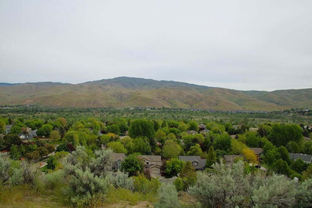
I visited nearly all of the accessible trails in the Ridge to Rivers trail system and encountered barriers on most of them. All of the trails are fairly rugged with natural, sand or gravel surfaces, and several are used by mountain bikers and horseback riders, which creates ruts and dips in the trail that can be difficult to navigate with mobility equipment. The trail systems are well-signed with maps and trail markers.
Here are three trails that are wheelchair accessible if you have off-road tires or all-terrain equipment. I refer to these trails as “wheelchair hikeable.” They are generally accessible for people who do not use a wheelchair, but there are no benches, so bring something to support you if you need to sit. The City of Boise allows people with mobility disabilities to use an e-bike on some trails in the Ridge to River trail system. To obtain a permit, bring proof of your disability and documentation about your e-bike to the Boise Parks and Recreation office.
Here are my suggestions for rugged, wheelchair-accessible trail options in the Boise Foothills.
Hulls Gulch Reserve | Gold Finch Trail & Hulls Pond Loop
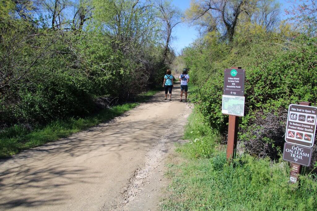
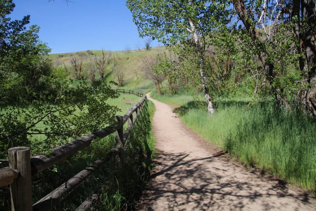
Hulls Gulch Reserve is named for the ephemeral creek that flows down the foothills and through the center of the reserve. This 0.75-mile lollipop loop is wheelchair hikeable. It follows the creek and encircles a pond. There are areas of shade and a few places to pull out and enjoy sitting by the creek. Not only that, this is a good spot for birding and encountering wildlife like deer, foxes and snakes. Remember to never approach wildlife.
Begin at The Grove Trailhead, next to a large trail board at the southwest corner of the parking area. Take the Gold Finch Trail, which is compacted sand and four feet wide, and pass through the trees and grassy areas. The trail is slightly crowned (higher in the middle than on the edges) as you cross over a culverted stream, and there is a drop-off on the right side with no barrier. The trail dips and rolls slightly but continues generally level with a few avoidable rocks that rise up to three inches above the surface.
At approximately 0.2 miles, the trail inclines at 5–8% for about 20 feet with some loose gravel on the surface, then levels out again. Pass by three large memorial plaques engraved with the names of community members who helped create the reserve. You’ll then reach an intersection at a wooden fence—go right on Hulls Pond. The three-foot-wide trail is compacted sand. Cross a level footbridge over a creek with a nice little waterfall. There are a couple of places to pull off under the shade of the trees.
Go left at the next intersection to continue on Hull’s Pond. It is a nice area—the foothills rise above you on the right, and a wooden fence protects the pond on the left, with a scattering of trees and open grassland. The trail splits around a slight rise (the left side is flat but has a steep cross slope, and the right side has an 8% incline and is slightly washed out down the center). Continue to the left at the next intersection with Red Fox Trail. The trail widens to eight feet, and the sand is slightly loose.
Take a left at the next intersection with a trail board to continue on the Hulls Pond Loop. The trail is slightly crowned at an 8–10% incline with ruts on both edges for 20 feet. It then levels out again as you travel along the creek, and there is one nice, level spot to pull out under the shade. At just past 0.5 miles, you reach the end of the loop. Go left to return to the parking area on the Gold Finch Trail.
Things to Know
Stats: .75 miles, 60-foot elevation gain, 8% maximum grade, minimum three feet wide, compacted sand surface
Pets: Yes, on leash
Trail Users: Hikers, mountain bikers, horseback riders
Getting There: Grove Trailhead, 8th Street. From downtown Boise, take North 8th Street for 1.3 miles. Continue straight when it turns into Mile High/Sunset Peak Road. Continue .3 miles to the parking area on the left.
Parking: Large unpaved parking with potholes and no designated ADA parking
Accessible Features & Amenities: None. There are no restrooms, water or benches.
Contact: Ridge to Rivers, 208-493-2531
Looking for more opportunities to spot birds and animals? Take a look at these other accessible Boise wildlife adventures.
Hillside to Hollow Reserve | Harrison Hollow Trail
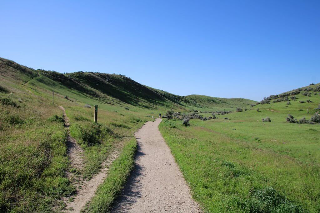
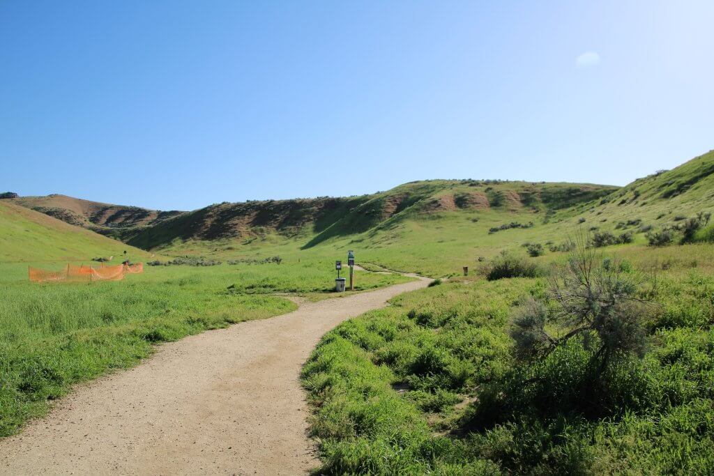
The Harrison Hollow Trail in the Hillside to Hollow Reserve is a lovely trail that travels up a hollow with hills rising on both sides. It might feel tucked away, but in reality, you are only a mile from downtown. There are wonderful views of the foothills, the Owyhee Mountains and Boise to the south. The reserve is a large open space—it is undergoing restoration to repair native habitats, but for the most part, it is open grassland with some sagebrush, and there is no shade. Pets are allowed off-leash, so you are sure to encounter lots of dogs during your visit. The entire trail is just shy of 0.9 miles, and it is wheelchair hikeable for the first half mile.
The trailhead is to the right of the restrooms, next to a large trailboard. The trail starts off at eight feet wide and is made of firm, compacted sand with some loose gravel. It takes a 2–5% incline for about 50 feet, then levels out. From that point, there is a 2–5% cross-slope for 20 feet as you approach a large stone memorial commemorating the people who helped create the Reserve. The trail continues generally level and narrows to four feet wide. There are a couple of small potholes and dips in the trail, but they are passable. Take a 2–5% incline for 20 feet before continuing on generally level terrain. You’ll find yourself tucked into a natural drainage, surrounded by hills on three sides. At approximately 0.3 miles, continue straight past the fork for the loop trail and take a 5–8% incline for 20 feet before leveling out briefly.
At 0.5 miles, the trail passes a footpath to the Harrison Hollow Ridge Trail and begins a steady 2–5% incline. Wheelchair users may want to turn around here because, at 0.6 miles, the surface starts to get uneven with lots of potholes and ruts. There are a few sections of double-track trail that are two feet wide and divided by lumpy grass, and then the trail gets progressively rougher. There is another possible turnaround point at 0.7 miles, but it may be a tight turn.
Things to Know
Stats: 1.5 miles, 120-foot elevation gain, 8% maximum grade, minimum three feet wide, compacted sand and gravel surface
Pets: Yes, off-leash
Trail Users: Hikers, mountain bikers, horseback riders
Getting There: From Boise, take North Harrison Boulevard north for one mile. Cross Hill Road and continue onto Bogus Basin Road. In 0.10 miles, go left onto North Harrison Hollow Road. Continue to the end and park in the last parking area on the left.
Parking: Paved parking lot with one van-accessible parking spot
Accessible Features & Amenities: Accessible all-gender restrooms with flush toilets, a drinking fountain, trash cans and dog clean-up stations
Contact: Ridge to Rivers, 208-493-2531
Oregon Trail Reserve | Oregon Trail & Rim Rock Loop
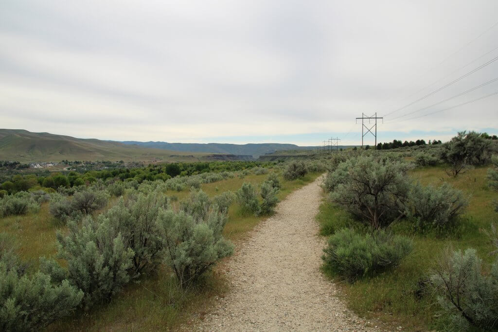
The Oregon Trail Reserve preserves part of the historic Oregon Trail route. This is a pleasant loop with multiple overlooks of the basalt cliffs above the Boise River. You can also see wagon ruts left by settlers and the historic Kelton Ramp, where they navigated the cliffs down to the river valley. Interpretive signs explain the cultural and historic significance of this place.
While the trail is listed as accessible and features a wheelchair-accessible overlook, it does present some access issues. The majority of the trail is deep, loose gravel that is a challenge to walk on and may be difficult for many wheelchair users. It is generally three to four feet wide, but there are some areas pinched by grass or sagebrush, and it would be difficult to turn around if you get stuck.
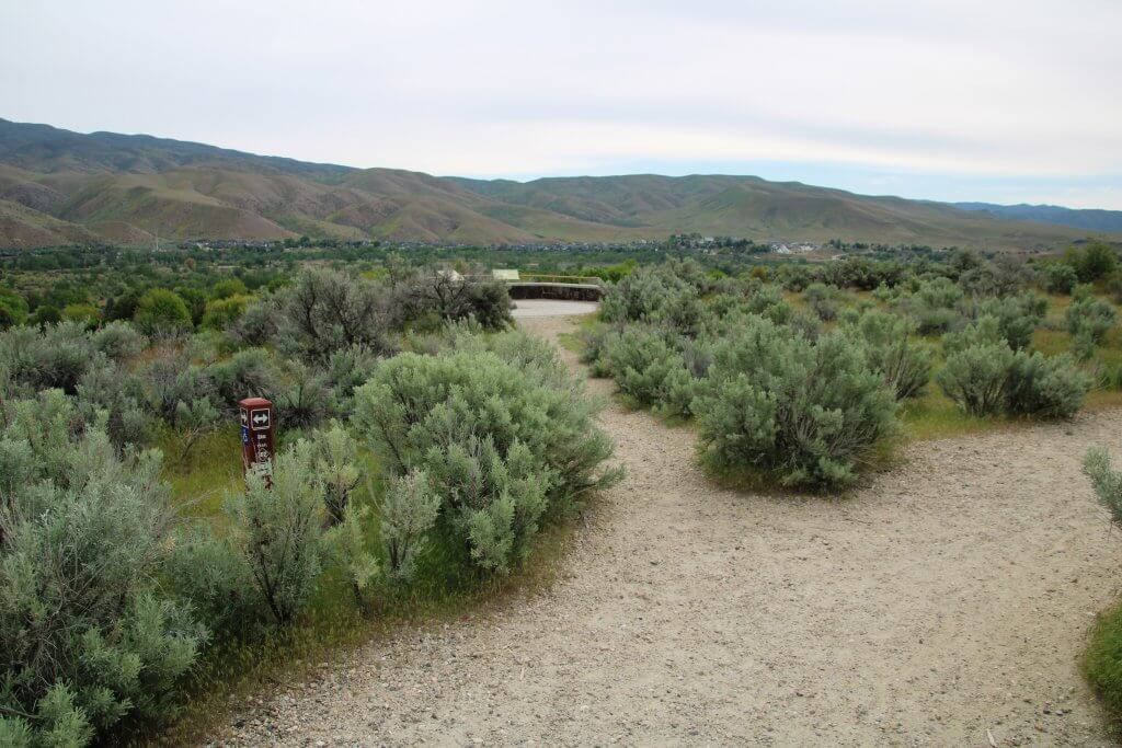
From the Whitman Trailhead, the trail starts at four feet wide on loose gravel. The trail curves right from the trailhead, traveling through sagebrush and grassland, with views of the foothills to the left. In a few hundred feet, the trail forks— continue left to the Whitman Overlook. A post with a wheelchair-accessible symbol directs you to the overlook. The trail surface is large, loose gravel. Take a 3% incline for 30 feet, level out and then take a 5% decline for 15 feet on loose gravel up to an inch deep. The trail narrows to three feet, curves and then gets a little rutted and uneven. Cross the bike trail, and then you’ll come to an area of loose gravel that is more than two inches deep. The trail narrows to two feet with sagebrush on either side. Continue across the Rim Trail on a narrow path to get to the overlook. The overlook has views of the valley to the foothills—to the right, you can see the Boise River canyon, and to the left is downtown Boise. There are two benches and interpretive signs.
From the overlook, go left on the Rim Trail. It starts at five feet wide and is made up of a mix of loose gravel and compacted sand. At 0.4 miles, the trail inclines 2–5% for 20 feet, levels out and then starts to roll a few times, continuing on with large, loose gravel. At 0.5 miles, it starts a 2–5% incline for 50 feet. There is another overlook on the left with signs about the Indigenous people and the impact of settlers on the area. From the overlook, go left and continue on Rim Trail.
At 0.6 miles, you’ll pass the Kelton Trailhead on the right. You can cut through here and pick up the Oregon Trail (head right to return to the Whitman Trailhead), but the path is narrow. There are benches and accessible restrooms at this trailhead with flush toilets and sinks. The access points at the Kelton Trailhead are not accessible—one has a steep decline with a barrier, and the other has 34 inches of clearance between two signs, but there is thick grass that may be difficult to navigate.
Continuing on the Rim Trail, the surface remains deep, loose gravel. At 0.9 miles, pass the bike trail on the right, and then you’ll immediately reach a fork with the Oregon Trail on the right. The Rim Trail continues straight ahead to another overlook, but the connection to the Oregon Trail from there is steep. So if you go to the overlook, you may want to double back to this fork.
Continuing back on the Oregon Trail, you’ll pass some houses, and there are historic wagon ruts on the right. The trail becomes an uneven, firm, compacted surface as you approach the Kelton Trailhead again. The trail then returns to a loose gravel surface, generally three to four feet wide, with a few places pinched by grass. The gravel is more than an inch deep in some places and presents slippery footing. At two miles, you’ll return to the Whitman Trailhead.
Things to Know
Stats: Two miles, 20-foot elevation gain, 5% maximum grade, minimum two feet wide, loose gravel surface
Trail Users: Hikers, mountain bikers
Pets: Yes, on leash
Getting There: Whitman Trailhead at the corner of Lake Forest Drive and Orchid Way. From downtown Boise, take North Capitol Boulevard for 2.5 miles and continue on South Federal Way. In 2.5 miles, turn left on South Yamhill Road, then left on East Lake Forest Drive. Continue 1.7 miles to the parking lot on the left.
Parking: Paved parking with two accessible spots, 20 spaces total
Accessible Features & Amenities: Benches and picnic tables. Water fountains are not accessible.
Contact: Ridge to Rivers, 208-493-2531
Travel With Care
This time of year, the conditions of trails can change in a matter of hours. Remember, if you’re leaving tracks, turn back. Continuing to use muddy trails or stepping outside of the trail to avoid mud causes severe erosion and damage to vegetation. Before you head outdoors, plan ahead and check for trail conditions and closures. Take a look at this page to learn more about how to Travel With Care.
Looking for more ways to explore Idaho? Check out the guide to accessible activities in Idaho to find additional wheelchair-accessible trails and other adventures.
Updated on November 20, 2023
Published on April 11, 2023
